Geothermal Exploration
This document was uploaded by user and they confirmed that they have the permission to share it. If you are author or own the copyright of this book, please report to us by using this DMCA report form. Report DMCA
Overview
Download & View Geothermal Exploration as PDF for free.
More details
- Words: 1,659
- Pages: 40
Loading documents preview...
Exploring for geothermal energy
Presented by Dr. Ólafur G. Flóvenz, general director of ISOR – Iceland GeoSurvey at Renewable energy training program Module 3 - geothermal energy
Conceptual model of a high temperature field
Figure: Kristján Sæmundsson, ÍSOR © www.isor.is ©
We need careful exploration: O
A deep exploration borehole in a high temperature field can cost several million USD.
O
The total cost of geo-scientific exploration is only a part of the cost of one such well.
O
However, exploration requires considerable up-front cost prior to exploration drilling. Therefore: –
Exploration methods must be selected with respect to the site
–
Exploration must be carried out in professional manner
–
Stepwise approach is recommended, i.e. the strategy must be revised as the results appear.
www.isor.is ©
Scales of Exploration: O
Regional exploration: Exploration covering large area in order to identify possible geothermal resources and roughly assess their size.
O
Local exploration: Exploration that concentrates on the interior of a known geothermal field in order to identify the best production sites and target for drilling to obtain maximum energy output with minimum cost.
www.isor.is ©
The selection of exploration methods O
The geology of geothermal fields are quite variable from one place to another.
O
There is no single exploration procedure that can be applied universally to all geothermal fields.
O
The selection of exploration methods must be tailor-made for each field.
O
But we have guidelines to form suitable exploration strategy for each field.
www.isor.is ©
Regional exploration – The first 3 phases of geothermal development 1.
Review of existing data
2.
Reconnaissance
3.
Geological Exploration
4.
Geophysical Exploration
5.
Exploration Drilling
6.
Preliminary Resource Estimate These studies end in a pre-feasibility report
www.isor.is ©
Step 1. Review and study available data
www.isor.is ©
Step 2: Reconnaissance • •
Desktop study of all available data Field studies: • • • • • •
• • • •
Visual studies, maps, photographs (infra red) Mapping of the manifestations Temperatures and flow rate Mapping of soil temperatures Fluid sampling and analyses (geo-thermometers, fluid chemistry) Historical data on activity and utilization
Ownership and rights (licensing) Environmental aspects (EIA) Social aspects Market possibilities
Are there market opportunities in developing the area? www.isor.is ©
Mapping of manifestations, temperature and flow-rate. Mapping of soil temperatures Chemical analysis of springs and gas from steam vents gives information on reservoir temperatures. www.isor.is ©
Geothermometers: O
If we have access to the geothermal fluid through hot springs, steam vents or borehole we can take samples for chemical analysis
O
From the results of the analysis we can calculate and estimate the likely temperature in the underlying reservoir.
www.isor.is
© ICELAND GEOSURVEY
Geothermometers: CO2-temperature map of Torfajökull geothermal system, Central Iceland
www.isor.is ©
Step 3: Geological Exploration • •
• • •
Geological mapping (lithology). Structural geology (faults, fractures, dykes). Volcanology and volcanic history. Hydrogeology. Geo-hazards and environmental geology.
Does the surface activity relate to geological structures ?
www.isor.is ©
Geological maps:
The Nesjavellir field (above). Lithological units (right corner). Geothermal map: Tectonic fractures, surface manifestations and alteration (to the right) www.isor.is ©
Geological maps are basis for environmental assessment: Special geological phenomena that must be protected The risk for geological hazards like eruptions and earthquakes is based on evidence of these events in the field, estimate of their timing and frequency, seriousness and likely effects on power plants.
www.isor.is
©ICELAND GEOSURVEY
Step 4: Geophysical Exploration • • • • • •
Resistivity – TEM (0 -1 km) & MT (0-25 km) Micro seismicity (2 - 10 km) Heat flow Gravity Magnetics (dykes, faults) Seismic reflection (only in sedimentary rock)
How big is the active resource and selecting the drilling targets. www.isor.is ©
The important resistivity measurements O
The best available geophysical method.
O
The only method that is sensitive to geothermal properties of rock.
O
Two main types, TEM and MT, should be used together.
O
Has limitations and pitfalls must be avoided
www.isor.is ©
Resistivity structure of a typical simple high temperature field:
www.isor.is ©
Important to know: The resistive core shows a volume where temperature has reached at least 230°C for some period of time during the geological history of the geothermal field. It is not necessarily so hot to-day: If the hot resistive core cools down the resistivity will not lower correspondingly. This must be tested by drilling. Hence the resistivity do not tell us where to drill to obtain 230°C – but it tells us definitely where not to drill. New or improved exploration methods are needed to predict temperature variations within the resistive core.
www.isor.is ©
Micro-seismicity O
Gives information about location of active faults.
O
Helps to define drilling targets.
O
Can show location of magma bodies.
O
Can give information on the elastic crust.
O
Can show fluid flow in factures.
© ICELAND GEOSURVEY
Distribution of microearthquakes and focal planes in Krafla geothermal field, Iceland
Earthquake section through Menengai, Kenya www.isor.is
Gravity and Magnetic maps O
Give structural information.
O
Gravity anomalies show distribution of abnormal masses in the underground.
O
Magnetic maps can reflect thermal alteration of rock.
O
Should rather be used on local scale that regional. Hengill, Iceland. Gravity map. www.isor.is ©
Heat flow O
Measurement or temperature gradient in shallow boreholes.
O
The heat flow must be conductive not convective
O
Most high temperature fields are covered by thick permeable formation that make heat flow studies impossible or expensive.
Temperature logs from a high temperature reflecting fluid flow in permeable rock. The red line show the expected conductive heat flow if 240°C is expected at 1 km depth www.isor.is © ICELAND GEOSURVEY
Information gained from Surface Exploration (Preliminary geothermal model) O
Estimation of the size of the geothermal resource and its exploitable thickness:
O
Estimation of the reservoir temperature
O
Expected reservoir fluid chemistry
O
Definition of drilling targets and type of exploration wells to be drilled
O
The information should be incorporated into a preliminary conceptual model of the field.
O
Volumetric assessment made to get a first estimate of the power potential of the resource.
www.isor.is
© ICELAND GEOSURVEY
From the exploration results we can make rough assessment of the size of the resource The surface exploration can give the maximum volume of the geothermal reservoir. The first approach to evaluate the resource is to carry out a volumetric assessment of it. It can be done by applying rules of thumb or by more precise volumetric assessment based on statistical methods. If all results are positive we go for the next step, the exploration drilling.
www.isor.is ©
Result from the first four steps: Preliminary conceptual model. Selected site and design of exploration wells (shallow, intermediate or deep wells).
www.isor.is ©
Step 5: Exploration Drilling (sub-surface exploration) •Testing the results of the resistivity exploration •Confirming/updating the conceptual model • Confirming the temperature estimation of surface sampling • Confirming the chemical composition of the brine •Confirming the existence of a geothermal resource • Flow-testing the reservoir • Update the reservoir model •
Is it likely that the geothermal resource is exploitable, and what kind of power plant is viable? www.isor.is ©
Additionally to drilling O
Well siting
O
Well design
O
Drilling supervision
O
Mud logging
O
Borehole logging
O
On site geological consultancy
www.isor.is ©
Well testing of exploration wells O
Temperature- and pressure logging
O
Injection- and flow testing
O
Well stimulations
O
Tracer- and interference testing
www.isor.is ©
Step 6. Preliminary Resource Estimate and updating the conceptual model.
www.isor.is ©
Volumetric assessment The first approach to evaluate the resource up on completing the surface exploration is to carry out a volumetric assessment of the resource. This assessment is improved by the information gained from the exploration drilling, often by applying Monte Carlo statistics to the volumetric assessment.
www.isor.is ©
Regional exploration - concluding remarks O
It is our experience that the investment in executing a thorough surface exploration program is money well spent
O
One failed well due to negligence in exploration can cost several times the cost of the surface explorations
O
Surface studies should therefore have high priority in all geothermal exploration programs
O
Regional exploration and exploration drilling ends in a pre-feasibility report, with some preliminary power plant designs. www.isor.is © ICELAND GEOSURVEY
Local exploration: O
If regional exploration is successful further development takes place.
O
Local exploration is necessary to define drilling targets in order to maximize the energy output from new wells: • Find the up-flow zones of the • Find permeable fractures • Find fault zones and intrusions • Find cooling magma bodies www.isor.is ©
Local exploration requires several methods: O
Densely spaced resistivity soundings, preferably three dimensional interpretation.
O
Detailed fracture mapping close to the drill site.
O
Micro-seismic studies, before drilling, and during drilling and well tests or stimulation.
O
Well logging and borehole geological data.
O
Gravity or magnetic studies.
www.isor.is ©
Resistivity section from Reykjanes high temperature field showing a conductive cap, a resistive core, shallow high resistivity below the steam vent area (boiling?) and possible horizontal flow away from the up-flow zone.
www.isor.is
© ICELAND GEOSURVEY
Detailed fracture mapping
Gas flux measurements in the field showing underlying fractures.
www.isor.is ©
Detailed tectonic and geothermal map
www.isor.is
©ICELAND GEOSURVEY
Micro-seismic studies for fractures Example showing how distribution of microearthquakes fall on a straight line during injection test. The line denotes a permeable fault that is target in drilling
www.isor.is ©
Application of well logging data Temperature cross section based on temperature logging in boreholes. It shows clearly the upflow zone of the geothermal water.
www.isor.is ©
We need to improve the exploration tools: O
Better tools for data processing and interpretation
O
Joint interpretation or processing of resistivity and seismic data.
O
Devices for laboratory measurements of rock samples at 200-600°C that can handle fluid filled porous rock.
www.isor.is ©
Concluding comment:
Well organized and professional exploration is the basis for successful and viable geothermal projects.
www.isor.is ©
The end
IEA-GIA September
www.isor.is
Related Documents

Geothermal Exploration
March 2021 0
Science-geothermal Surface Exploration
March 2021 0
Vgg13_geophysics For Geothermal Exploration
March 2021 0
Landsat 7 Etm+ On Geothermal Exploration
March 2021 0
Oil Exploration
March 2021 0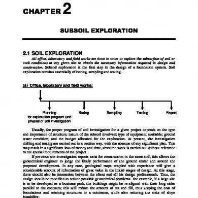
Ch2 Subsoil Exploration (15-71)
February 2021 2More Documents from "rafi"
Geothermal Exploration
March 2021 0
Edward Macdowell 3 Songs Op.60
March 2021 0
Stategic Pr Plan
January 2021 4
3000 Ktruc Vn.xlsx
January 2021 0
5.700 Chi Tiet Giam Doc Tai Tphcm
January 2021 0